
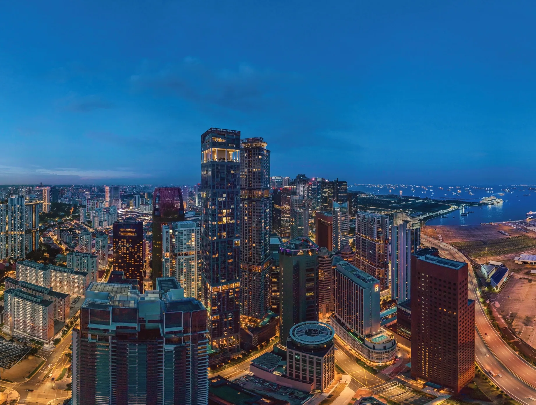
 Photograph · for illustration only
Newport Residences stands at 80 Anson Road, District 2, on the corner of Bernam Street at the southern edge of the Central Business District. Three MRT stations are within walking distance, and a link bridge leads towards Prince Edward Road station.
Newport Residences Location Map
Map centred on Newport Plaza, 80 Anson Road (1.27326, 103.84359). Open Newport Residences in Google Maps.
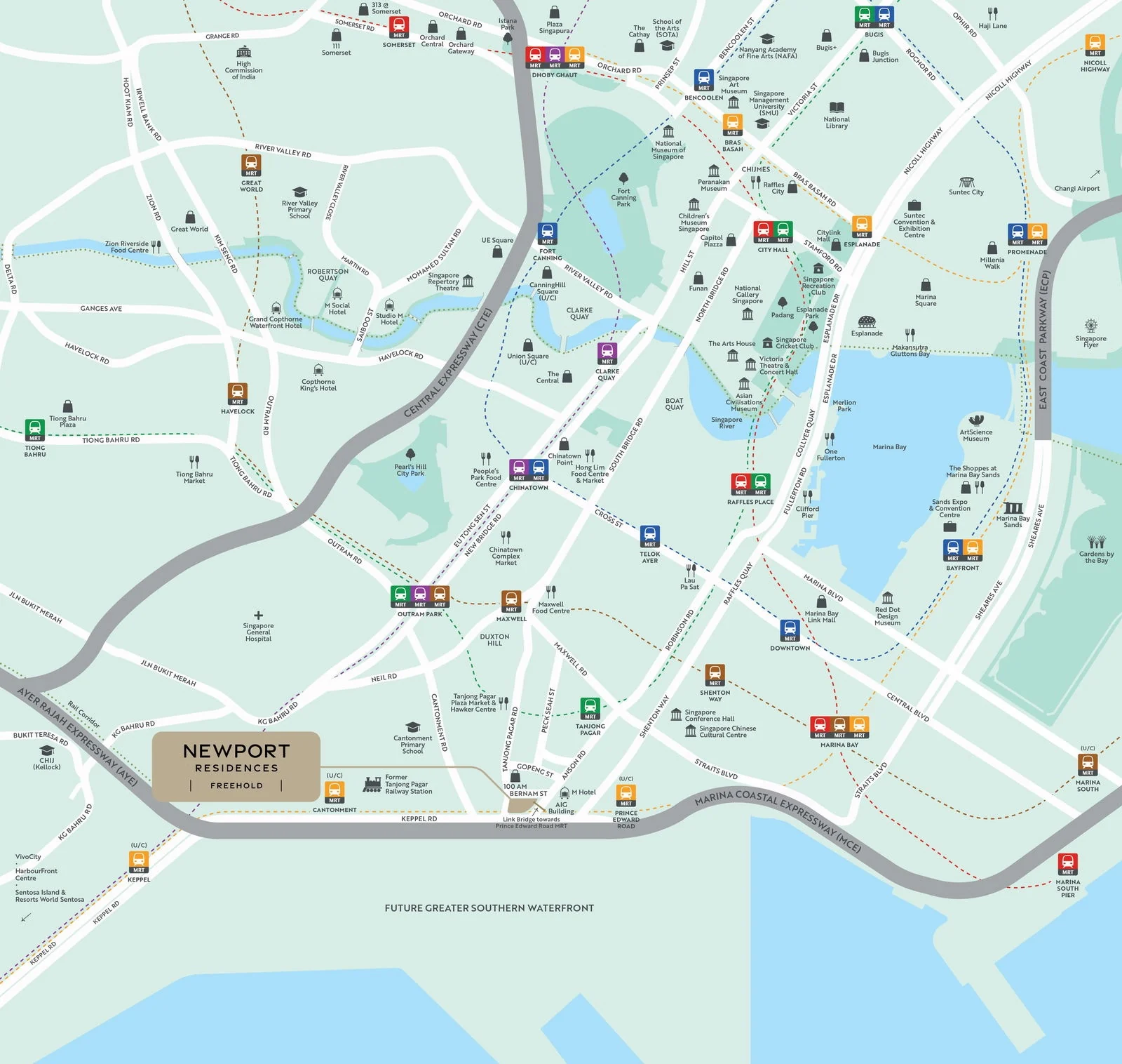
Anson Road runs along the site towards Tanjong Pagar and Shenton Way, Bernam Street along its northern side, and Keppel Road and the Ayer Rajah Expressway to the south and west. The towers of the financial district rise to the east, while the conserved shophouses of Tanjong Pagar and Duxton Hill begin a few minutes’ walk to the north-west.
The developer’s map groups the neighbourhood in four: parks and recreation (Sentosa, Pearl’s Hill City Park, the Rail Corridor, Fort Canning Park and Gardens by the Bay); arts and culture (the National Gallery, the National Museum, the Esplanade and the ArtScience Museum); retail and dining (100 AM, Duxton Hill, Boat Quay, Clarke Quay, Robertson Quay, Marina Bay Sands, Suntec City, Orchard Road and VivoCity); and work and learning (the CBD, the Marina Bay Financial District, Cantonment Primary School and CHIJ (Kellock)).
Newport Residences Distances
The distances below are straight-line measurements from the site on OneMap; walking routes are longer. They show what lies within reach of Newport Residences: three MRT stations on foot, the shops and food of Tanjong Pagar, two hawker centres and the landmarks of Marina Bay.
Within about 900 metres
| Destination | Straight-line distance |
|---|---|
| 100 AM | about 150 m |
| Prince Edward Road MRT station, Exit 1 | about 220 m |
| Tanjong Pagar MRT station, Exit A | about 380 m |
| Cantonment Primary School | about 470 m |
| Pinnacle@Duxton | about 490 m |
| Cantonment MRT station, Exit 3 | about 610 m |
| Maxwell MRT station, Exit 3 | about 770 m |
| Maxwell Food Centre | about 800 m |
| Shenton Way MRT station, Exit 6 | about 870 m |
About 1.1 to 2.7 kilometres
| Destination | Straight-line distance |
|---|---|
| Lau Pa Sat | about 1.1 km |
| Raffles Place MRT station | about 1.5 km |
| Outram Secondary School | about 1.6 km |
| CHIJ (Kellock) | about 1.7 km |
| Marina Bay Sands | about 2.1 km |
| VivoCity | about 2.6 km |
| Gardens by the Bay | about 2.7 km |
Measured on OneMap (SLA) from the site. School distances should be confirmed with the MOE SchoolFinder.
The neighbourhood around Newport Residences
The tower sits where the financial district meets Tanjong Pagar and the coast. Across Keppel Road, the port lands are set to become the Greater Southern Waterfront as the city terminals move to Tuas, with a continuous promenade planned from Marina Bay to Pasir Panjang.
Five area guides look further: the MRT stations, the Greater Southern Waterfront, Tanjong Pagar and Duxton Hill, the CBD and Marina Bay and schools nearby.
Request the Newport Residences Price List
Newport Residences is open for sale, and the Sales Concierge sends the current price list with the homes still available on Levels 23 to 45. Showflat viewings are arranged by appointment through the Sales Concierge.
Sent on request
- The current price list with the homes still available.
- The e-brochure and the floor plans for the home types you shortlist.
- A worked payment schedule and the stamp duty for your profile.
- A showflat appointment arranged around your diary.
Request the Price List
No obligation. The Sales Concierge responds personally to every enquiry.
Prefer to speak to someone? Call +65 6200 6220, or send a WhatsApp message to the same number.